The Plantation was meant to establish Londonderry as Ulster’s main city


A new exhibition which gives a snapshot of life during Plantation times details how Londonderry was meant to be the focal point for the province of Ulster.
The ‘Plantations in Ulster: 1600-41’ touring exhibition by the Public Record Office of Northern Ireland (PRONI) has been revised and updated to coincide with the 400th anniversary of Derry’s Walls.
Advertisement
Hide AdAdvertisement
Hide AdStephen Scarth, head of public services at PRONI who helped to put together the exhibition, said: “That early 17th century period (when Ireland was under English rule) is really where modern Ireland begins.
“When the Earls leave Ulster their lands get confiscated and six of the counties are then basically planted (colonised with settlers from Britain).”
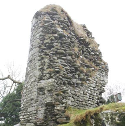
Of the situation in Ulster prior to the Plantation, he said: “Ulster was always seen as the most rebellious of the four provinces. The least Anglicised, the most Gaelic. It was seen as the province most likely to rebel, and it did rebel.”
Led by Earls Hugh O’Neill and Rory O’Donnell an Irish Alliance had fought English rule before leaving for mainland Europe with a band of around 90 followers after their defeat.
Advertisement
Hide AdAdvertisement
Hide AdStephen said: “This was the Crown’s final solution, to colonise the confiscated lands with English and Scottish settlers. The plan was for it to be mostly English, the fact they didn’t get enough of them to come over is why the Scots then arrived.
“Counties Antrim and Down weren’t part of the planned plantation but they ended up being part of it – the Scots came over anyway and settled there.”
Detailed planning for the proposed plantation of the six confiscated counties began in 1609.
The appointed English and Scottish landlords were known as ‘undertakers’ and agreed to observe various conditions included settling people from England and Scotland within a defined time at a minimum density of 24 adult males per 1,000 acres.
Advertisement
Hide AdAdvertisement
Hide AdIn terms of the creation of County Londonderry and the city of Londonderry, Stephen said: “It didn’t exist as a county before, it was mostly part of County Tyrone.
“The most important places at that time would have been Carrick, Armagh and Coleraine. Belfast was just a hamlet of minor significance. The intention was for Derry to become the main harbour and the main city in Ulster. It was a plan that only came to half fulfilment.
“There’s always been a settlement of some sort in Derry, but this was a brand new planned settlement built with funding from the London companies.
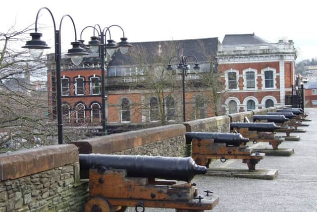
“If you look at Derry you’ve got the walls, the big wide streets, the diamond at the centre. Walls aside, you see that in very many Ulster towns. That was imposed as part of the Plantation.”
Advertisement
Hide AdAdvertisement
Hide AdThe influx of new settlers, along with the extensive building programme and the establishment of new fairs and markets, invigorated the Ulster economy.
A page (contained in the exhibition) from the Londonderry Port Book for July 1615 shows the importation of luxury goods such as ‘raisins of the sun’, currants, Castile soap and salad oil, along with manufactured goods including frying pans, iron pots, kettles and crockery ware.
Weapons such as firearms and armour were also imported – an indication of concerns about the security of the Plantation settlements.
The exhibition includes a 1625 petition from tenants at Moneymore which gives an insight into the everyday life of British settlers in the newly established county of Londonderry.
Advertisement
Hide AdAdvertisement
Hide AdTheir complaints to their landlords – the Drapers’ Company of London – cover a range of issues including the undeveloped state of the settlement, as reflected in the unpaved streets, unfinished buildings and the lack of a market or fair in the locality.
They are also concerned about the lawless nature of the area. Numerous dispossessed and landless people – known as ‘wood kern’ – were living on the fringes of the new settlements, particularly in wooded areas, and attacks on settlers and their property were common.
The settlers write: “To speake of the dangerousness of the place werein wee live.
“Wee here beinge dayly subiectt to the incursions and continuall stealthes of the woodkerne, w[hi]ch these p[ar]ts allwaies hitherto have been subject unto, and wee thinke will nev[e]r be free from.
Advertisement
Hide AdAdvertisement
Hide Ad“Manie of yo[ur] poore tenn[an]ts havinge lost in one night (verye lately) fower or five head of cattle, being all that ever they have had in the world.”
As well as introducing more British settlers to Ireland, the Plantation was designed to increase the footprint of the Protestant Anglican Church (known here as the Church of Ireland).
Stephen said: “One of the key things was it was also meant to strengthen the Church of Ireland, very much at the expense of the other two religions - Catholics and Presbyterians.
“You see a lot of Anglican churches being built at the time. It’s the first time you see markets arriving, it’s the first time we see fortified buildings appearing, they’re all part of the Plantation period.”
Advertisement
Hide AdAdvertisement
Hide AdThe exhibition is contained in a number of printed storyboards showing a combination of materials that have originated in PRONI.
Stephen said: “We have things like maps and plans, we’ve got a few genealogies, then we have some indentures, leases, that type of material on goatskin.
“On top of that we’ve got more contemporary photographs from the Historic Environment Division.”
He said: “It’s aimed at anybody interested in Irish history, anybody interested in the 17th century in Ulster and particularly the 400th anniversary of Derry’s Walls.”
Advertisement
Hide AdAdvertisement
Hide AdThe exhibition showcasing some of the oldest documents and images from the period is based on an earlier PRONI resource Plantations in Ulster, 1600-41.
That collection of documents was first published in 1975 and edited by the late RJ Hunter.
A new and revised version was published in 2018 by the Ulster Historic Foundation and which is now available electronically at www.nidirect.gov.uk/proni
PRONI’s exhibition will run across the Province’s libraries until the end of May. To find out where it will be in the forthcoming months, follow PRONI at www.facebook.com/publicrecordofficeni